An interview with Forensic Architecture’s founder Eyal Weizman. « Overground Gaza becomes de negative shape – the reflection – of Underground Gaza. »
Gaza is currently at the heart of the work of Eyal Weizman, the British-Israeli founder of Forensic Architecture, a research agency that uses spatial techniques to investigate state violence.
Forensic Architecture’s evidence has been presented at the International Court of Justice supporting South Africa’s charge of Israeli genocide in Gaza1, and Weizman is writing a book about Gaza (to be published by Fern Press in the Spring of 2025) that will take a deeper, historical-geological approach — a sort of « worm’s eye view » of the Gazan subsoil.
After 7 October 2023, it has become even more difficult to be, like Weizman, an Israeli leftist committed to the cause of a free Palestine. It means being in double mourning, and doubly isolated from fellow mourners: Weizman’s teenaged daughter had friends who were killed in the Nova Music Festival massacre, while an ever-growing number of the Forensic Architecture team’s Gazan colleagues, friends and family members are being killed in the ongoing Israeli assault.
Issue Three of the ERB (Spring 2023) included a profile by Fernanda Eberstadt of Weizman. In late May 2024, Fernanda Eberstadt spoke to Eyal Weizman again, on the phone — Eberstadt from New York, Weizman from London. What follows is an edited and condensed transcript of their conversation about Gaza and the forthcoming book, called Ungrounding. Weizman answers one of the biggest mysteries about the digging of Gazan tunnels: where does all the sand go?
Fernanda Eberstadt: What are you working on right now?
Eyal Weizman: Ghassan Abu Sitta2 came into the office, we’ve been recording his testimony using a 3D-model of Al Ahli and Al Shifa hospitals. His testimony is fascinating. It reminds me of Medecins sans frontières’ practice of temoignage — bearing witness. Physicians by day, witnesses by night. I think the most important testimony in Gaza comes from the medical workers: a hospital constitutes this nexus of information, this central nervous system, because in a catastrophe, it’s where people come running. Ghasan Abu Sitta is in an interesting position: first, he recalls the testimony of patients and their families, who give an eyewitness account of what they saw on the roads getting to the hospital. Secondly, he’s an expert witness who can identify what kind of munitions caused the wounds he’s treating [including internationally banned chemical weapons such as white phosphorus]. And thirdly, he himself is a survivor and an eyewitness who can report on what he was seeing, as the hospital in which he’s trying to perform surgery comes under attack.
The Abu Sitta family is incredible. Over the years, I got to know Ghassan’s uncle Salman Abu Sitta, a historian who is the foremost chronicler of the Nakba and the [Palestinian] right of return. Salman in his work has mapped and reconstructed life in the Gaza Envelope pre-1948. The Abu Sitta are very important to my understanding of Gaza. The family were Bedouin Palestinians from the Northern Negev who had owned and cultivated their lands for centuries.3 It was a family of prodigies who under Ottoman rule and under the British Mandate were sent to study in Istanbul, Cairo, Britain. Engineers, surgeons, judges. Salman’s father believed in education and built a school on his lands in the 1920s. Even when they were farmers in the Negev, they were the first to mechanize agriculture, they were the first to buy motorized water pumps and a tractor — though they got rid of it when they realised it trimmed the barley stalks too high, wasting precious organic matter. Salman Abu Sitta’s father and his older brothers were famous leaders of the Arab resistance in the Negev.
Salman remembers as a child playing on an ancient mosaic floor on his family’s land. After they were expelled, Israel marked the floor as belonging to a sixth-century synagogue. Salman writes that it was most likely a Byzantine church – there have been other Byzantine churches found in that area of the Negev that also contain Jewish symbols. Even if it was Jewish, it doesn’t confer rights or justify the expulsion of the Abu Sitta which occurred on the day Israel was declared, 14 May 1948.4 The Abu Sitta family belongs to the Tarabin tribe of Bedouins. The Tarabins controlled the trade route along the Via Maris from North Africa and Alexandria up to Damascus — a trade route that continued to be important under nineteenth-century Ottoman rule, and the one along which the British occupied Palestine in 1917. Through the Abu Sitta family, I am learning how central Bedouins are to Gaza. The majority of Palestinian refugees that ended up in Gaza are of Bedouin origins.
I noticed that there were a lot of Bedouin who were taken hostage or killed by Hamas on 7 October.
The long Zionist project has been to proletarianize the Bedouins, but more recently with the geriatric state of kibbutz life, they’ve also been mixed into an imported labor force on the kibbutzim along with Filipinos, Nepalese, Thai. The Bedouins were on both sides on 7 October: people recognized Tarabin-accented Arabic among the Hamas fighters.
I remember your writing about Bedouin villages in your book The Conflict Shoreline5. How does this Gaza book fit into your earlier work?
Working on the genocide in Gaza brings together aspects of previous books I’ve written, from Hollow Land, where I documented the militarization of architecture in the settlements, to The Conflict Shoreline where I wrote about the state’s use of the desert to displace Palestinians — to The Least of All Possible Evils, which deals with how humanitarian aid organizations are made complicit in state violence. But I have never written about Gaza before — in the subsoil of Gaza, it all comes together!
If you look at a map, you can see that Gaza is a hinge between the two shorelines of Mediterranean and desert, between the fertile Levant — where the coastline goes north/south — and the more arid North Africa where the coast goes east/west. All the communication and trade routes from pre-Roman through the Ottoman era have run through Gaza, and travelers have always commented on the sharp transition from the endless desert to the fertile country.
Gaza is a cone divided by this environmental frontier: Northern Gaza is lush, extremely fertile. By Khan Younis, it starts drying up very fast. The border in nineteenth-century maps is at Wadi Gaza — a north-west to south-east riverbed with many little tributaries. It’s a flood plain, a catchment area from Hebron and the mountains, and a huge reserve of biodiversity. Rivers are drawn on a map in a reductive, stupid way – if you want to do it properly, rivers are not lines but more like leaves. Each thread of the leaf, each tributary and stream historically was settled by a different Bedouin clan or family, they knew how to control the seasonal flooding with dams and to collect the rainwater, they planted wheat and barley: in the nineteenth-century, the fields along the Wadi Gaza area were exporting barley to Liverpool for beer! South of the Wadi Gaza start the puddles of dunes. In 1948, people were pushed into Gaza from the east along the water lines, some of the wells were poisoned by the Israeli army, populations were pushed farther and farther south into aridity and settled all the way down in Rafah, which the Ottomans had repurposed as a Bedouin administrative center. Israel has always coveted the fertile land of Northern Gaza. On 13 October, all residents of Northern Gaza were ordered to evacuate to south of Wadi Gaza. Gaza is so overbuilt that many didn’t even remember there was such a Wadi. Israel destroyed Gaza City and built fortifications close to the river. Not far from where the Ottomans built their line of defense against the British in World War I.
Forensic Architecture is documenting Israeli actions in Gaza, whereas it sounds as if this new book is more theoretical, more of a history of how Gazans have found ways to live under siege. Including the tunnels.
It’s a worm’s eye view of the conflict. Do worms even have eyes?
Nope.
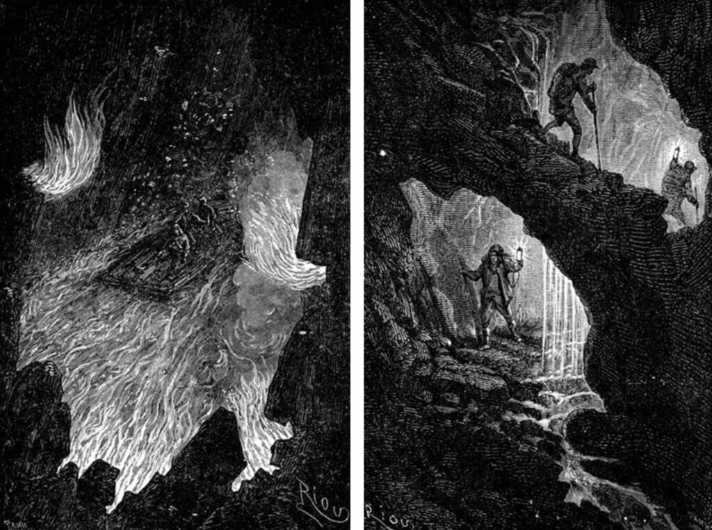
It’s a new departure, far from our usual methods, involving a whole different set of techniques. Usually in Forensic Architecture we’re mining the hypervisibility of contemporary media, the seen, locatable, the analyzable. Here I’m trying to go beneath the surface of the earth to understand the deep geological history of the Palestinian retreat. You cross the surface and most signals draw a blank. It’s at almost an imaginary volume, only that it is very real. If surface life in Palestine has become unlivable, then you have to burrow underground to survive. It’s the subterranean Nakba. Gaza’s geology is a meeting point between sand brought in via the Nile and piling up on the shore, and alluvial soils draining from the southern West Bank mountains — clay along the riverbeds, sand deeper and wider in the south. Farmers understand the soil surface and depth. To understand the tunnels in Gaza, you have to start with the wells. Gaza historically had the deepest wells in the region — the one in [Salman Abu Sitta’s village] Ma’in Abu Sitta, for example, was 95 meters deep. If you want to dig a well in Gaza, you look for trees, you start not too close to the roots. When you start digging, the sand is loose on the surface, and below, the soil is fossilized dune, rock dust blown in from the Nile Delta mixed with quartz from sea animals, seashells. Where there is chalk, it acts as a binding agent, naturally occurring concrete. You shovel through sand dunes, it gets harder when you reach the kurkar — sandstone — then you’re on to pick-axes and hammers. But once you break past the kurkar, you’re down to clay and that’s excellent, full of iron. Gaza clay was used for amphorae storing oil and wine. Below the clay is the aquifer – not an underground lake or river as you might imagine, but porous rock with air bubbles full of water — a kind of sponge. You need to hit the rock in a mosaic kind of way, to provoke the water to seep out.
So the well-diggers eventually became tunnel diggers?
By necessity. In the 1980s, for the first time the coastal traffic, the flow of communication was broken. Israel created a hard border at Rafah, between the neighborhoods known as Canada and Brazil built around UN bases of the respective countries. Tunneling started almost immediately as the fence went up, people were crawling in shallow dugouts under the fence. When Israel built concrete foundations, they went deeper. The first full tunnel was discovered in 1984. Egyptian soldiers noticed sand piled near a house.
When you try to connect between the basements of two houses, you use a compass and measuring tape. But because of the real curvature of the earth, there are always differences in distance and maps can’t be fully trusted. Deeper tunnels begin in wells or shafts. The wells are made before the tunnel because it’s harder digging upwards. Sometimes you make a shaft and wait like a fisherman dropping a hook and line into the subsoil, and only months or years later a horizontal tunnel will connect to it. The tunnels have multiple origins, but they were also a Tarabin social and economic network: families that had been trading for centuries along the Via Maris, navigating between a network of wells across the desert, importing goods from as far as Libya or Turkey were suddenly divided by a border. « The border crossed us, we didn’t cross the border. » Every tribe, every clan has its own intergenerational lines of affinity, of political affiliation, and the tunnels follow these lines.
A tunnel doesn’t just suddenly surface in someone’s back yard.
There are questions of familial trust, political alliance. The tunnel network is a social network. You learn to navigate a buried landscape. Your body needs to adjust to the low levels of oxygen, the humidity, it takes time, you need to breathe in a particular way, you don’t drink much before in order not to perspire, you become a worm.
When the first Intifada erupts in 1987, it’s no longer just for goods: people are escaping, military materiel starts entering the tunnel. With the Oslo Accords comes the fence separating Gazan and Egyptian Palestinians, later [after Hamas’ 2006 election victory] Gaza is under siege. By 2006/7, the tunnel has become a lifeline, bypassing the siege and the settler economy. Structural engineers, contractors, builders left unemployed, systematize the network, taking it deeper than the sand level. The clay layers of Northern Gaza are the medium through which the « metro » moves, not only horizontally. The deep layer of clay is like a landscape of hills, lakes, valleys – a landscape without silhouettes, that you can only experience in a tactile way, with the tips of your fingers. You’re moving through this negative architecture, the tunnel as a clay vessel. But subsoil navigation does not only cross natural layers, Gaza’s is an anthropocenic soil that’s composed of multiple demolitions, reconstructions, demolitions. The top geological layer is broken concrete. It’s a battle over deep earth, deep topography.
Who constructs the tunnels?
Before 2007, most diggers came from Rafah, from Bedouin families, it’s their specialty. You need to be small: limber boys or young adults. No oxygen — light a cigarette and you suffocate. After 2007 it becomes a state infrastructural project. Techniques change between northern and southern Gaza, there are different challenges according to the soil: sand is tricky, unstable, it needs reinforcing with wood and concrete; clay enables greater maneuverability, but it requires you to move with it, resulting in unpredictable zigzags, crazy shapes and forms. That’s what the Israeli army found, trying to retrieve [captured IDF soldier] Gilad Shalit.
One of Israel’s biggest questions about the tunnels has been, from the first one found, where does all the sand go? The Israeli military tries to map the evacuation routes — as you dig, the displaced sand needs somehow to be disposed of. Well, concrete is sixty percent sand. Every time Israel demolishes a building, Gazans rebuild it. The concrete with which homes are built is where the sand is hidden. Buildings are like sand pumps. Overground Gaza becomes the negative shape — the reflection — of Underground Gaza. »
In a talk at e-flux in Brooklyn on 16 February, you mentioned how all the metal from bombed buildings in Gaza gets in the way of Israel’s trying to see what’s going on in the tunnels.
Each building the Israeli military demolishes contains metal girders that then sink underground, reinforced steel that doesn’t allow radar or magnetometers to penetrate. By their continuous bombings, the army has created a hidden veil between their own optics and what’s happening underground.
The soil must be pretty contaminated?
The soil and the subsoil. The establishment of the state of Israel is contemporaneous with the Green Revolution: the fields in the Israeli agrarian settlements of the Gaza Envelope — « where the plough ends, the border begins » — have been doused with generations of fertilizers, herbicides, pesticides that wash down through Gaza towards the sea. Multiple sources of environmental damage: the settlers’ monopolizing of water, their farming methods deplete the water table in this fragile ecosystem; the Israeli military’s razing of Gaza — the dropping of depth bombs — release toxins into the ground.
In addition, there is the seawater that the army is pumping into the tunnels in the hopes of flushing out Hamas fighters — salt water that will also seep into the water table. We’re talking about multigenerational waves of ecocide, the destruction of the depth. A free Palestine can only survive underground, but then you realize that every layer of this subsoil is contaminated.
You’re writing about a place that’s secret, hidden — that’s continually being destroyed and maybe re-forming — a place that may no longer exist by the time you’re done.
This project definitely raises ethical questions, clear boundaries for me. Normally I’m trying to uncover human rights violations. Here I see the tunnels as a project of survival and liberation.
How do you respect those boundaries?
I am not trying to expose what’s hidden. I write only about the specific tunnels that were discovered, reported upon, by each side. Only open sources. I’m exploring the texture and tactile sense. There’s a different time frame, too — the temporality of the subsoil is much longer, slower, it’s more like a garden than architecture, its history is a discursive, social structure. If I’m the worm, I’m only seeing what’s in front of me. I’m robbing myself of every tool we have in Forensic Architecture, which depends on the bird’s eye view, on techniques of visibility, satellite imagery, aerial surveillance. The subsoil is about viscosity. Muck. Materiality that you can touch as a defining architectural experientiality — and also about fantasy and speculation. The tunnels are phantasmatic. In the subconscious of Zionism: this people we expelled from the soil, from mind and eye, return to haunt us from the subsoil.
Speaking of a Zionist subconscious: it’s hard enough to compass what this war — if war is the right term — is doing to Palestinians. What do you think it will do to Israelis?
If Israel is left to itself, it will create a wall at Wadi Gaza and build settlements in Northern Gaza. Everything depends on our preventing this outcome by doing smart effective work now. But there will be long term implications to Palestinian and Jewish-Israeli identities. The latter has been formed by the Holocaust. I can’t even begin to imagine the intergenerational effect on Jews having to come to terms with Israelis this time being the genocidaires.
- On 19 May, FA published « Inhumane Zones », its report to the ICJ on Israel’s « humanitarian zones » in Gaza. ↩︎
- Ghassan Abu Sitta is a Gaza-born British plastic surgeon and the rector of Glasgow University who last fall spent six weeks working in Gazan hospitals as they came under attack by Israeli forces. He was then barred from entering first Germany and then the entire Schengen Zone to testify to what he’d witnessed. The ban on his entry into Europe was subsequently lifted. ↩︎
- Salman Abu Sitta’s memoir Mapping my return describes the family’s thousand-acre settlement with its large eighteenth-century stone house full of European and Ottoman antiques and a library in which Shakespeare and the Quran sat side by side. ↩︎
- The Abu Sitta house was burned down by the Zionist paramilitary organization Haganah, and four kibbutzim were built on their land. ↩︎
- The Conflict Shoreline: Colonization as Climate Change in the Negev Desert by Eyal Weizman and Fazal Sheikh (Steidl, 2015) ↩︎